SLF reports Snow-Poor Winter, Pronounced Inner Alpine Old Snow Problem, Few Fatal Avalanche Accidents

The winter of 2024/25 is among the top 10 mildest winters since records began in 1864. Furthermore, there was a lack of snow in the Swiss Alps, especially in the east. The main reason for the lack of snow, even at high altitudes, was the low precipitation between November 2024 and April 2025 across most of the Swiss Alps. In contrast to the automatic IMIS stations above 2000 m, the lack of snow in winter 2024/25 was less exceptional at the stations below 1500 m, as mild winters at this altitude had already led to below-average snowfall in previous years.
The beginning of winter with little snow left many regions with a weak foundation for the snowpack. This critical old snow situation, with angular, soft layers deep in the snowpack, persisted throughout the winter, especially on shady slopes, particularly in the snow-poor regions of southern Valais, Ticino, and Graubünden. Frequent fractures in the weak old snowpack often led to widespread avalanche cracks and numerous medium and large avalanches. In contrast, the persistent weak layers in the newly snow-rich regions of the northern slopes of the Alps and western Lower Valais were mostly overlain by thick, well-consolidated snow layers.
The two most avalanche-active periods of the 2024/25 winter were the week of New Year's Day 2024 and the end of January 2025. By mid-April 2025, 10 people had died in nine avalanche accidents. The number of fatalities is significantly lower than the average of the last 20 years, although the number of avalanches involving people reported to the SLF is slightly above average.
Typical aspects of winter 2024/25
A real winter onset was delayed until late autumn – winter started initially only in the high mountains
Two winter storms were recorded in the mild autumn of 2024. In the glaciated high mountains above 3000 m, winter began as early as the beginning of October. Here, snowfall continued throughout the rainy and cloudy October. At lower elevations, however, most of the precipitation fell as rain. In contrast to October, November began very sunny and exceptionally mild in the mountains. As a result, until mid-November, a continuous snow cover remained only on north-facing slopes above 2800 m and in the high mountains.
It wasn't until the second third of November that winter truly arrived: in the west and north, from November 19 to 22, 2024, an extraordinary amount of snow fell, sometimes with gale-force winds, even at low altitudes. The extensive snowdrift accumulations settled on an unfavorable, angular snow surface, particularly on shady slopes. The avalanche danger increased significantly, at times reaching high (level 4) in the high mountains. Avalanches were primarily detected by automatic detection systems and reported from high-altitude ski resorts. After every autumn snowfall, numerous small gliding avalanches were released on the still-warm ground at mid- and high altitudes
White Christmas – lots of fresh snow and an “old snow problem” in the mountains
It snowed repeatedly in December 2024. A wonderful Christmas present arrived from December 21 to 24, 2024: persistent and intense snowfall in the west and north brought abundant fresh snow to the Swiss Alps, improving the snow cover above 2000 m. Along the northern Alpine ridge from Lower Valais to the Glarus Alps and in the Gotthard region, 1 to 1.5 meters of snow fell. In the remaining northern regions, approximately half a meter of snow accumulated. The south and the Engadin, however, received nothing.
Even before this heavy snowfall, it was clear that the entire old snowpack represented a weak foundation for the winter. Several dry periods dominated by high pressure and long, clear nights led to a buildup of snow metamorphosis. In many places, a pronounced weak layer of large, angular crystals with little bonding formed, which later developed into a ground-level old snow problem.
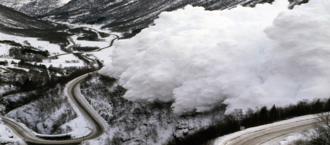
The large amounts of fresh snow and drifting snow deposited before Christmas covered the weak foundation – creating the layering combination necessary for slab avalanches. On December 23 and 24, 2024, a critical avalanche situation prevailed in the west and north, with widespread high avalanche danger (level 4). Fractures in the weak old snow led to widespread avalanche cracks and numerous large and very large natural avalanches.
Between Christmas and New Year's Eve, the mountains were sunny, windless, and exceptionally mild for this time of year, creating ideal conditions for touring and freeriding. However, it was one of the most avalanche-active periods of the 2024/25 winter: in just seven days, 98 avalanches were triggered by snow sports enthusiasts, trapping 22 people and burying three completely. The avalanche sizes were impressive: 58 medium-sized and 27 large avalanches were reported. The widespread fracture spread can be explained by the pronounced and widespread presence of weak old snowpack. The avalanche danger therefore remained persistently significant (level 3) in many regions of the Swiss Alps. Furthermore, the Christmas snowfall and the subsequent mild temperatures led to numerous gliding avalanches, especially in the snowy regions on the northern slopes of the Alps.
Stormy start to the year – the wind as the builder of avalanches
In addition to the long-lasting old snow problem, short-term drifting problems were also repeatedly in focus in the winter of 2024/25: Stormy conditions repeatedly led to instabilities in the fresh and drifted snow layers or at the transition to the near-surface old snow, as on January 18, 2025. In the northern foehn regions, strong southerly foehn winds transported near-surface, loose old snow onto an unfavorable old snow surface, creating a weak layer. As a result, many avalanches were triggered by people in thin, slabby drift accumulations. By January 19, 2025, the situation had already calmed down, which is typical for a drifting snow problem
Plenty of snow in the south – Ticino as the snowfall room of Switzerland
While the first and last third of January were changeable and very mild in the north with southerly foehn winds, heavy snowfall occurred in several bursts in the south and west. A particularly heavy snowfall was brought by a southerly blockage followed by a pronounced cold front between January 25 and 29, 2025. In the west and along the main Alpine ridge from the Lukmanier Pass to the Bernina Pass and south of there, over 1 meter of snow fell, while elsewhere on both sides of the Alps, about half a meter was widespread. The large amount of new and drifting snow was deposited on the thin and extremely weak snowpack. The high avalanche danger (level 4) forecast for January 28, 2025, was confirmed by the highest avalanche activity of the 2024/25 winter, with numerous large and, in isolated cases, very large natural avalanches. On January 29, 2025, the first day of good weather after the heavy snowfall, the situation for winter sports off the secured slopes was very critical. On this day, winter sports enthusiasts triggered many medium and large avalanches.
From February to early March, the weather was mild, generally dry, and there was plenty of sunshine in the mountains and in the south. After the heavy snowfall at the end of January, the old snow problem quickly subsided. There were only isolated reports of avalanches triggered in the deep layers of the snowpack and with large-scale avalanche cracks. Thus, the avalanche situation from February to early March was largely favorable.
From March 9 to 17, 2025, a significant southerly pressure blockage caused a wintry interlude with abundant snow in the south. Within a week, up to 1.5 m of snow fell in Ticino and the Simplon region above approximately 1,800 m, but up to 1 m of snow also fell in the west on the Great St. Bernard Pass and in the east from the Bregaglia Valley to the Bernina region. The snowpack regained momentum: in the south, particularly on north-facing slopes, the snow once again fell onto an unfavorable old snow surface consisting of angular, loose layers. This made the fresh snow and drift layers prone to triggering, and avalanches could be triggered in the upper part of the snowpack. In addition, weak layers deep in the snowpack in Valais, Ticino, and Graubünden again became prone to triggering. Here, avalanches again triggered in the old snow close to the ground, especially on shady slopes. On south-facing slopes, however, the situation was more favorable, as the snowpack was moist up to altitude before the snowfall. The large amounts of new snow temporarily raised the avalanche danger to level 4 (high), particularly in areas with a weak old snowpack in the south and southern Graubünden. Avalanche activity was high here, with numerous natural and human-triggered avalanches. In the Münstertal valley, in particular, the snowpack structure was exceptionally weak, making it a reliable area for fractures in the old snow close to the ground: dangerously large natural and human-triggered avalanches in the old snow had been reported here throughout the winter.
Winter final spurt – fresh snow, wind and many avalanches triggered by people
Who would have thought it? From March 29 to April 1, 2025, winter made up ground again, even in the snow-poor northeast, with up to half a meter of snow. However, fresh snow and loose old snow were blown away by the strong north wind and deposited on shady slopes on an unfavorable old snow surface. The result: several days of numerous natural and person-triggered avalanches. Adding to the drifting problem was an old acquaintance: weak old snow close to the ground. While in Ticino, the weak layers in the old snow had become heavily overlaid, making it difficult to initiate fractures, Graubünden remained the "old snow hotspot" of the Swiss Alps, with some avalanches triggered even in deep layers of the snowpack.
And what about wet avalanches? From mid-March to mid-April, the snowpack became significantly moistened by warmth and sunshine: on south-facing slopes up to high altitudes, on east- and west-facing slopes up to 2600 m, and on north-facing slopes up to 2000 m. The significant heat influence on the snowpack caused wet and gliding avalanches, but avalanche periods remained relatively mild until mid-April.
Climatological classification
The winter of 2024/25 was characterized by significantly below-average snow depths, primarily due to the low precipitation across Switzerland. However, the little precipitation that did fall mostly fell as snow, even at low altitudes. From a tourism perspective, it was very wintry for a short time in mid-November 2024 and around the Christmas season, with exceptionally heavy snowfall even at low altitudes. This resulted in snow depths being above average at 1000 m during the holidays, but below average above 2500 m. Furthermore, the numerous hours of sunshine had a positive impact on winter tourism. The greatest snow deficit was observed in northern and central Graubünden, where the drought was most pronounced. In mid-April 2025, at 2000 m, only 29% of the snowfall was recorded there compared to the long-term average from 1991 to 2020. In this region, almost all high-altitude automatic stations recorded record-low snow depths since mid-March since measurements began around 30 years ago. The snow depth measurement at the Weissfluhjoch measuring field (GR, 2536 m) above Davos, with its approximately 90-year measurement series, recorded below-average snow depths throughout the winter. Between April 7 and April 14, 2025, the least amount of snow was measured daily than ever before during this period—only 121 cm on April 14, 2025 (normal would be 218 cm). The last time there was a similarly low amount of snow in mid-April was in 1972.
The smallest snow deficit was observed south of the main Alpine ridge in mid-April 2025, at 42% of the 1991-2020 average. Across Switzerland, snowfall at 2000 m was 36% of the usual in mid-April 2025.
Such dry and snow-poor winters also have a major impact on the water levels of the Central Plateau. The water level at the FOEN station at Lake Constance (Untersee) was last as low as it will be at the same time in 2025 in mid-April 1972. In the Rhine catchment area, the maximum snow depths for the 2024/25 winter at 2000 m were already reached at the end of January; the normal time would be the end of March. In the regions south of the main Alpine ridge, however, this year's maximum snow depths at 2000 m were not reached until mid-March; the normal time would be early March.
Avalanche danger
Until April 14, the distribution of danger levels for winter 2024/25 was as follows: Level 1 (low) 15%, Level 2 (moderate) 61%, Level 3 (considerable) 23%, Level 4 (high) 1%, and Level 5 (very high) 0% . Periods of high avalanche danger (Level 4) were associated with heavy snowfall: at the start of winter (November 19/20, 2024) in the far west, before Christmas (December 22 to 24, 2024) in the west and north, at the end of January in the west, in the south, and in Graubünden (January 27 to 29, 2025), and in mid-March in the south (March 14, 2025). The end of January 2025 was the phase with the highest avalanche activity to date, with some impressively large avalanches in the south and in Graubünden. Fortunately, property damage remained minimal. From February to early March 2025, the avalanche situation was often favorable, with frequent low to moderate avalanche danger (levels 1 and 2). From the second half of March, as the snowpack became increasingly moist, the danger of wet and gliding avalanches increased throughout the day, usually reaching level 2 (moderate).
Compared to the average of the last 10 years, until mid-April, level 2 (moderate) was forecast more frequently, while levels 1 (low), 3 (considerable), and 4 (high) were forecast less frequently. Level 5 (very high) was not applied. The persistent phases of stable weather led to fewer periods of level 3 (considerable). However, the old snow problem in southern Valais, Ticino, and Graubünden simultaneously prevented a downgrade from level 2 (moderate) to level 1 (low).
Avalanche accidents and damaging avalanches
The number of avalanches and trapped persons was slightly above the average of the last 20 years, but there were fewer fatalities; avalanches causing property damage were significantly below the long-term average
A total of 172 avalanches (causing property damage and personal injury) were reported to the SLF from October 1, 2024, to April 14, 2025. These included 156 personal avalanches (average over the last 20 years: 134), affecting a total of 216 people. The number of people affected was also slightly above the average of the last 20 years, which was 205. It is encouraging that minor and relatively minor accidents are increasingly being reported to the SLF.
The number of avalanches causing property damage was 21 on April 14, 2025, significantly below the annual average of the last 20 years, which was 84 avalanches up to the end of September. However, the complete data on property damage will not be available until the end of September 2025.
By April 14, 2025, 10 people had died in avalanches (Figure 4). This number of victims was significantly lower than the 20-year average of 19 fatalities up to April 14. The annual fluctuations in the number of victims are subject to considerable randomness. Possible reasons for the low number of victims are: (1) no accidents with many fatalities, (2) the recorded avalanches generally had small crack thicknesses and were therefore less dangerous than in other years, and (3) a lot of luck. Another important reason for the low number of victims is likely that the rescue of fellow skiers was usually very well carried out. All of the victims were winter sports enthusiasts who were in unsecured terrain: eight people were on tours, two on off-piste runs. Two people were killed in one accident, and one in each of the other accidents.
A final assessment will not be made until the end of the hydrological year (September 30, 2025) in the winter report. Accident statistics may still change by then.
Avalanche bulletins
The avalanche bulletin contains an avalanche danger forecast and general information on the snow situation. It applies to the Swiss Alps, the Swiss Jura, and Liechtenstein. In winter and spring, it is published daily at 5 p.m. (French, Italian, and English versions by 6 p.m. at the latest) and is updated at 8 a.m., depending on the avalanche situation, especially during the winter months. It is published at www.slf.ch and in the SLF app White Risk.
This winter, the avalanche bulletin was published daily starting November 18, 2024.
The avalanche bulletin will be published daily at 5 p.m. until further notice, or at 8 a.m. depending on the avalanche situation. Situation-specific avalanche bulletins will be published during heavy snowfalls in summer and fall. To be alerted to these, you can activate a push notification on the White Risk app (push notifications: Summer Bulletin).


